East Side
ACRES BURNED
1,219
STATE
Montana
ORIGIN COUNTY
CarbonCONTAINMENT
100%
THIS FIRE IS STALE
This incident has not been updated in more than three days. Data may be inaccurate.
Response
LEAD AGENCY
Forest ServiceDetails
INCIDENT DETAILS
FIRE BEHAVIOR
MinimalNEAREST CITY
—DESCRIPTION
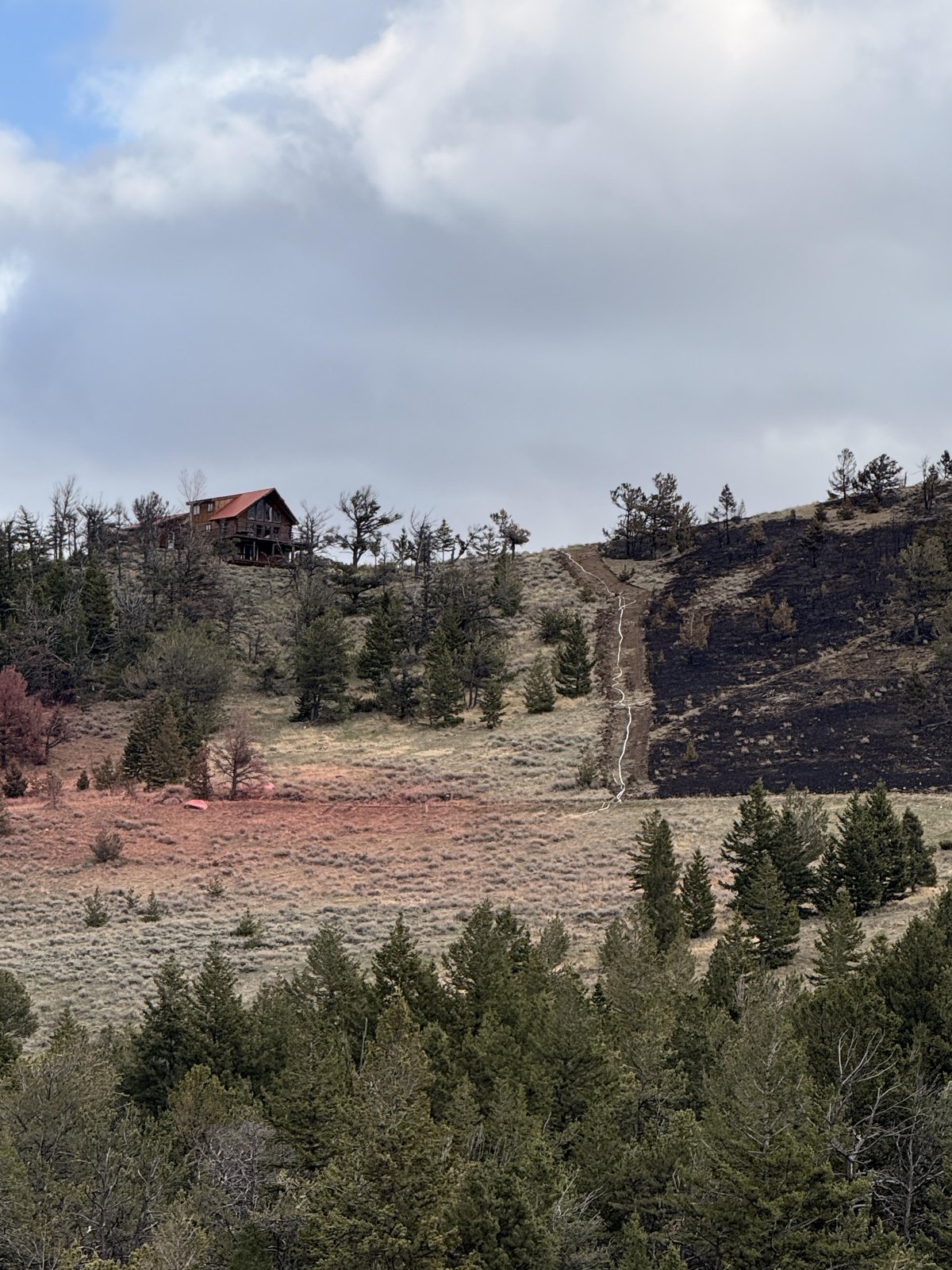
5 Miles S from Red Lodge, MT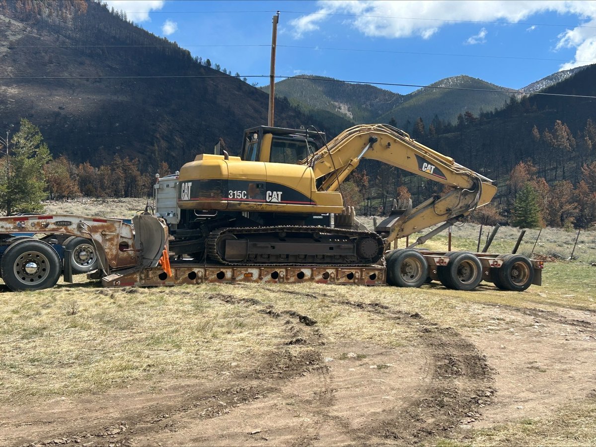
East Side Fire Report — May 18, 2026
Fire Start, Size and Growth
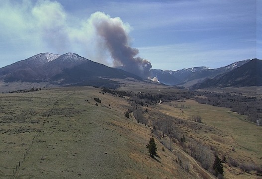
Start Date/Time/Location: The East Side Fire ignited on Monday, April 20, 2026, approximately five to seven miles south of Red Lodge in Carbon County, Montana, along the east side of U.S. Highway 212.
Size and Containment: Based on reporting over the last 72 hours, the fire has burned 1,219 acres and is currently 70% contained.
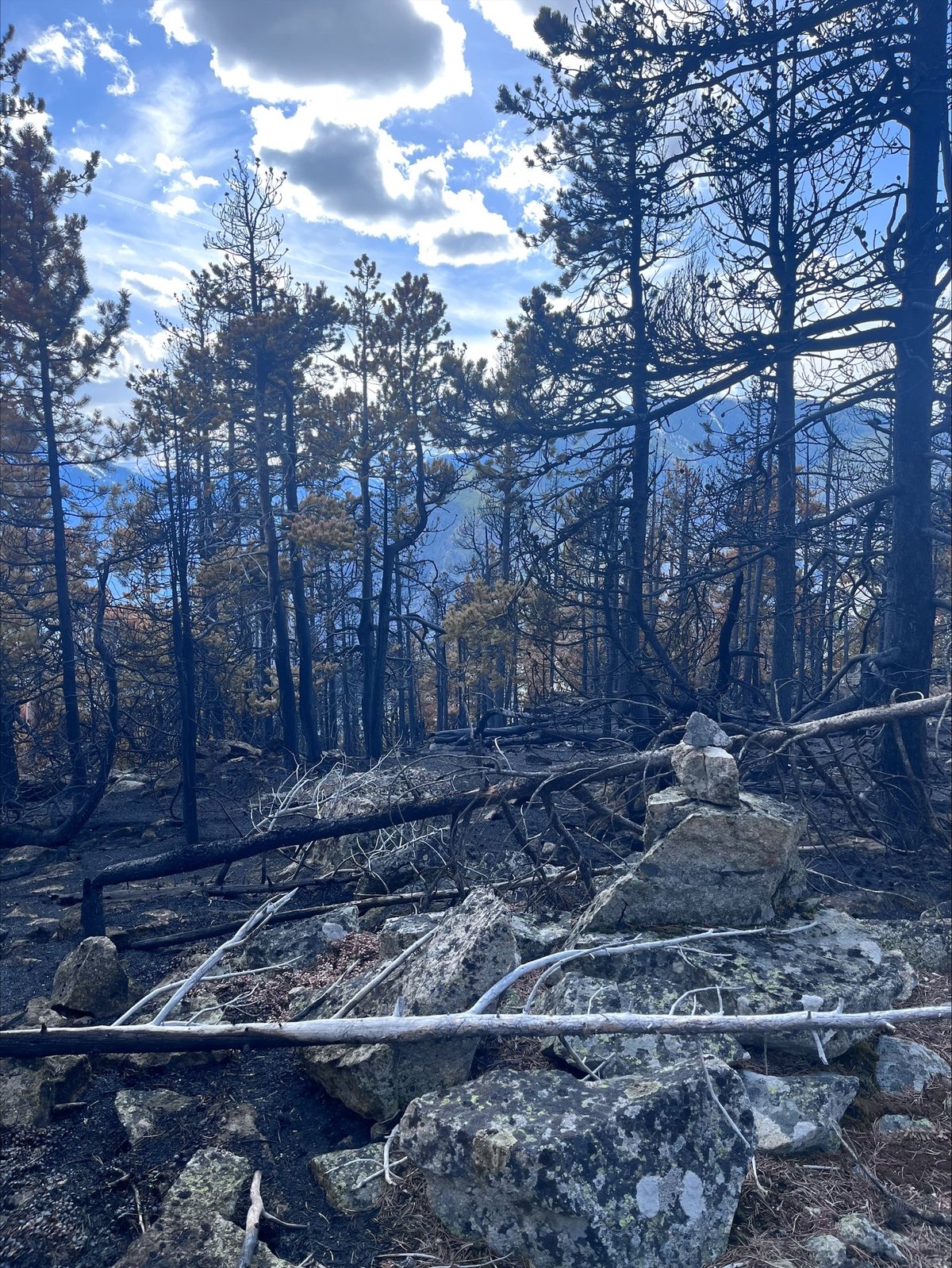
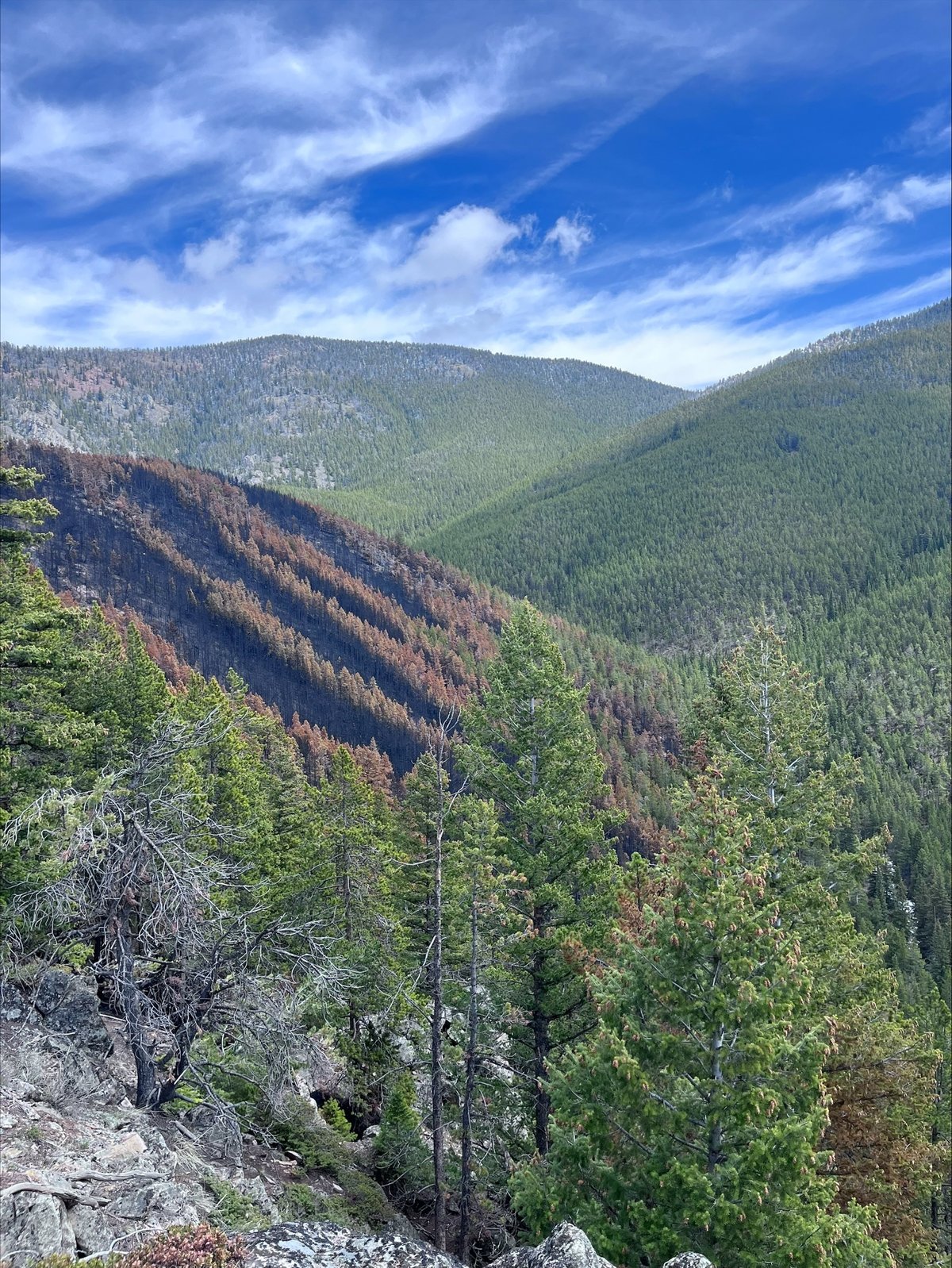
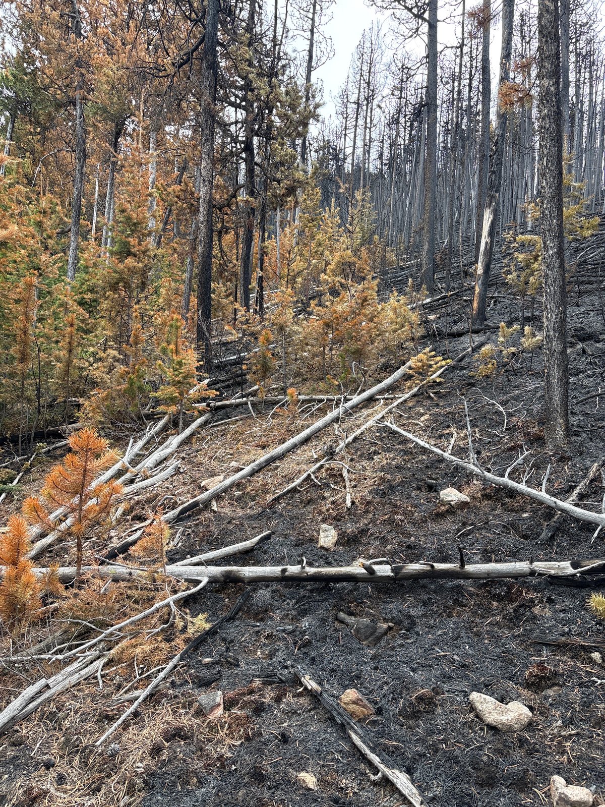
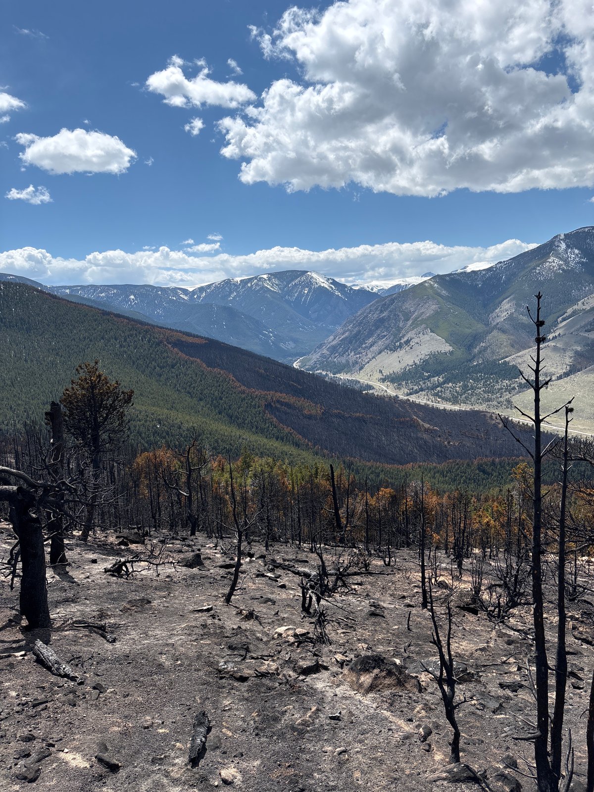
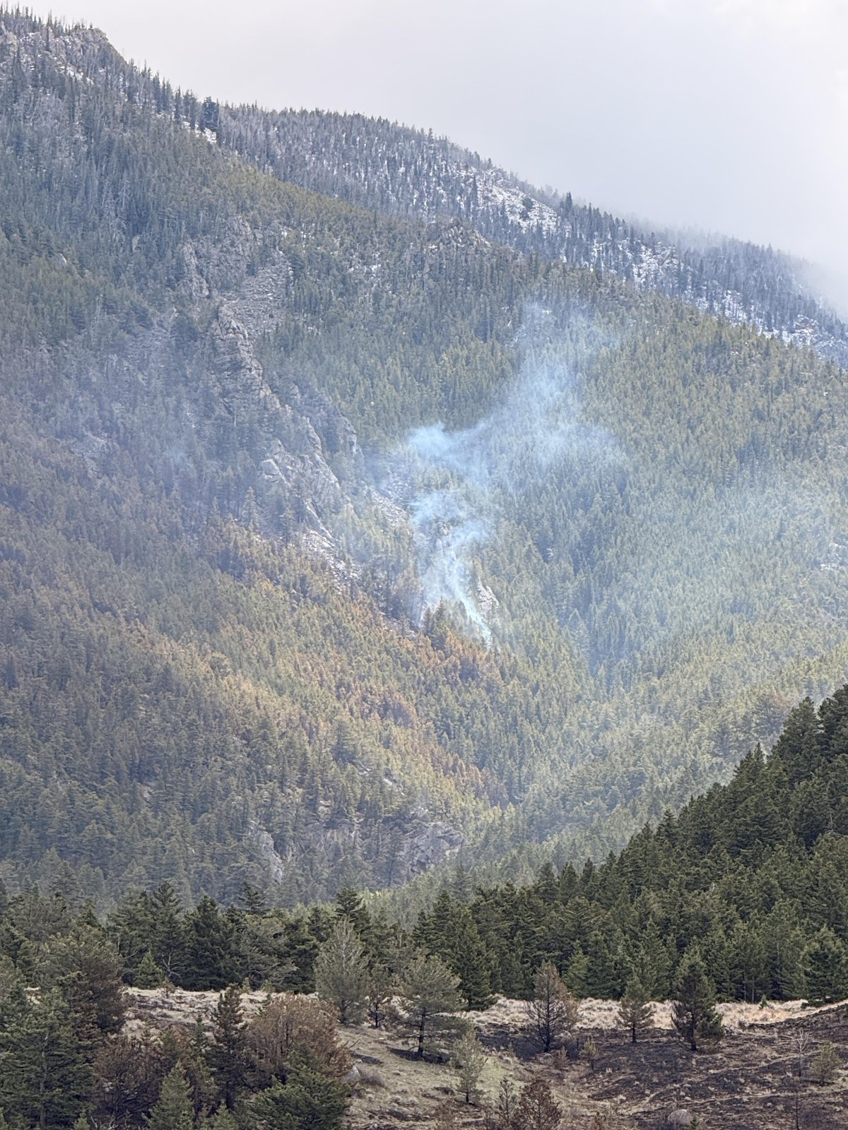
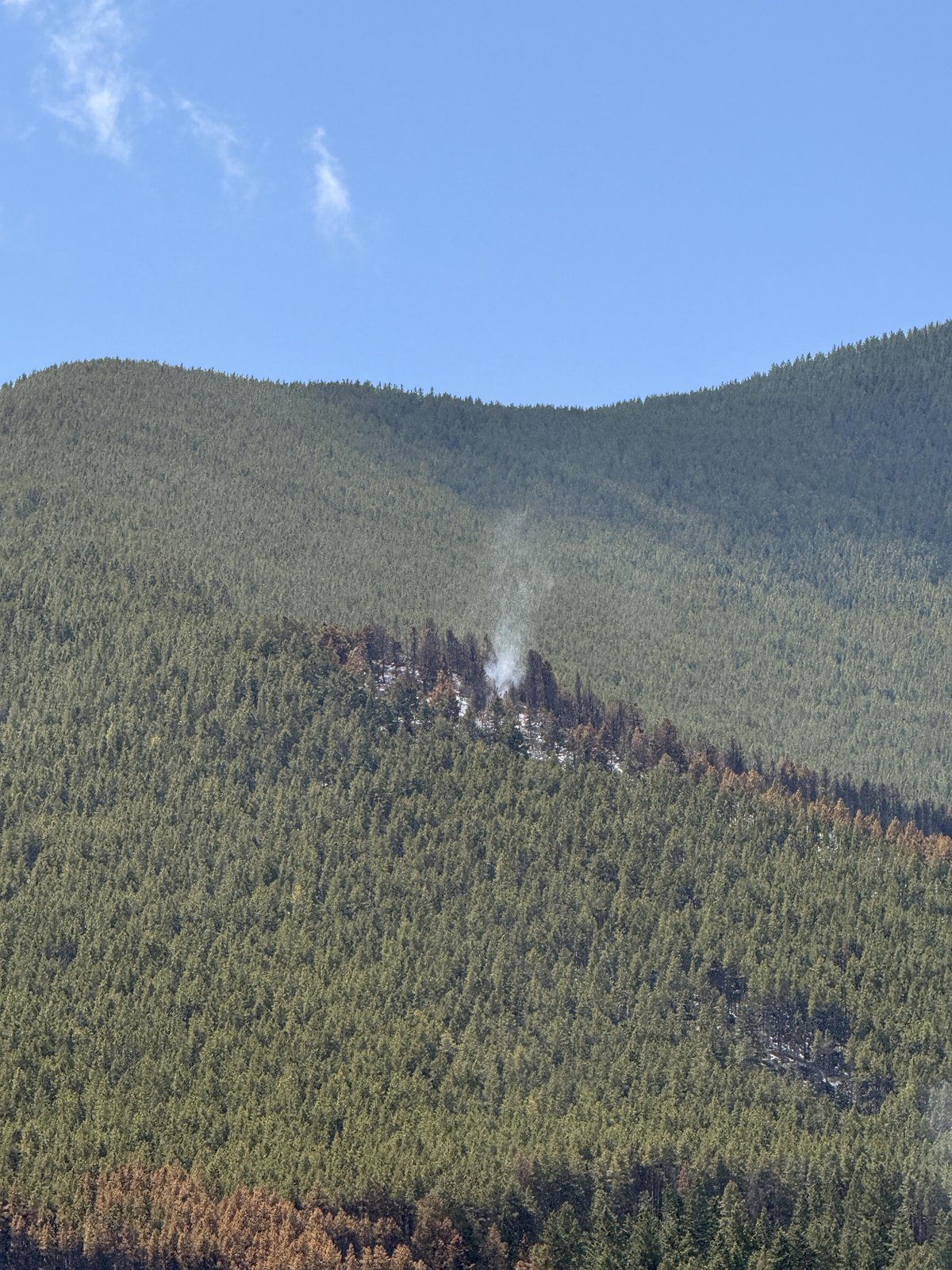
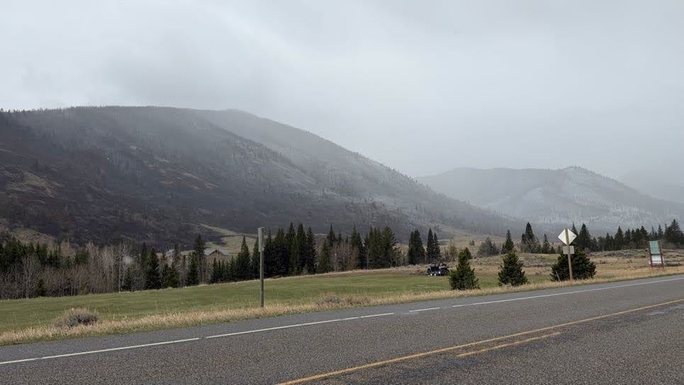
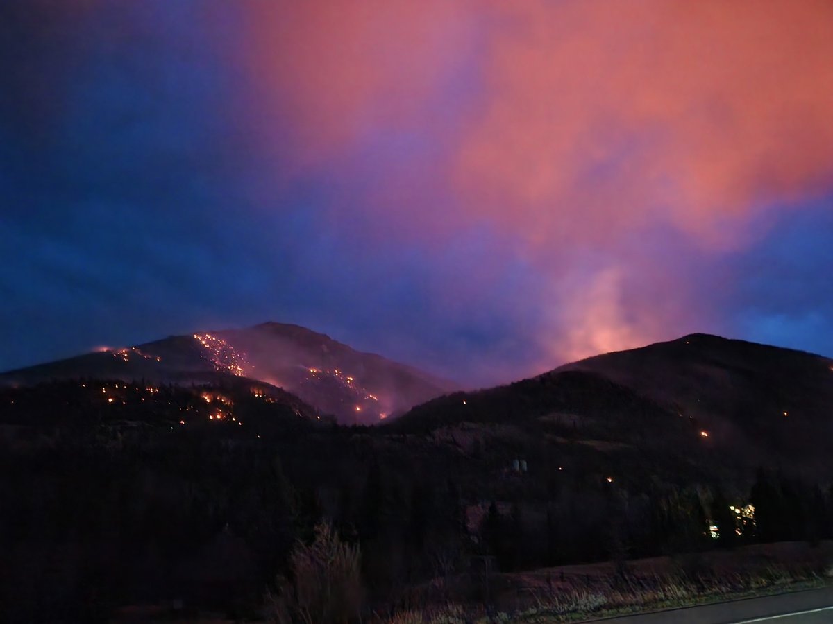
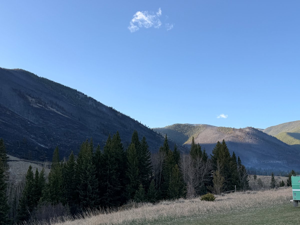
Fuels, Growth and Rate of Spread: The fire is burning in the Beartooth Range foothills, a transition zone between montane forest and high alpine terrain. It is primarily fueled by mixed conifer timber, tall grass, and understory. Initially, the fire spread rapidly due to dry, windy conditions, exhibiting slope-driven runs and short-range spotting across containment lines.
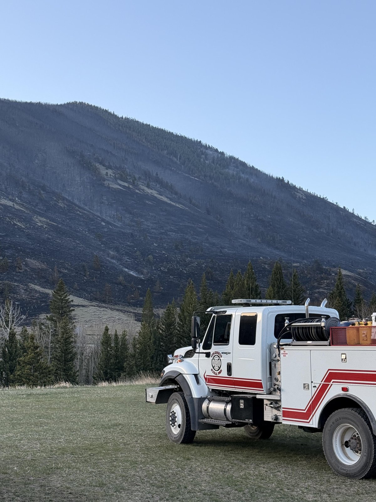
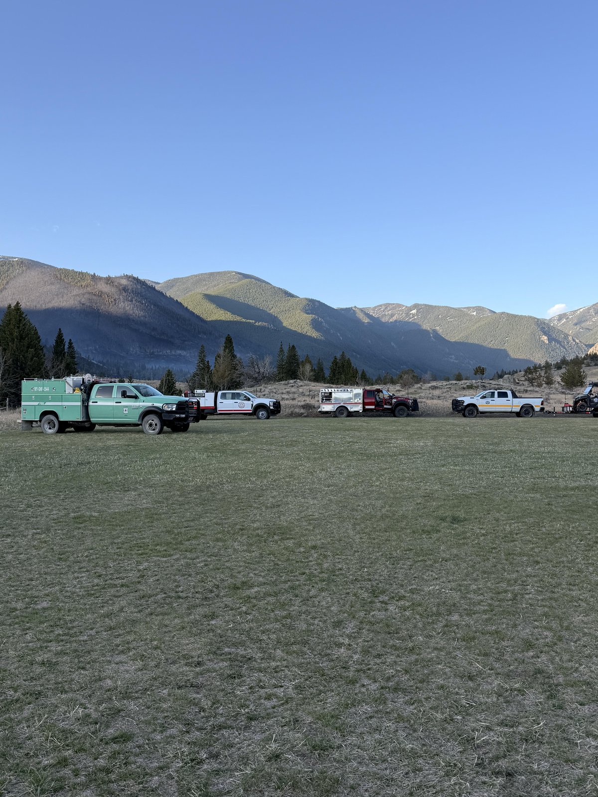
Containment Efforts: The Custer Gallatin National Forest is the lead agency managing the incident. Ground crews have made significant progress reinforcing and extending containment lines, supported by aerial resources. Firefighters successfully utilized dozer lines and strategic backburns to remove fuels and secure the fire's perimeter.
Emergency Information
Evacuations and Sheltering:
Mandatory Evacuation Orders: All mandatory evacuation orders have been lifted. At the height of the fire, approximately 185 homes were under evacuation orders in areas including south of Howell Gulch Road toward Lake Fork Road, and Meeteetse Trail Road.
Evacuation Warnings: All evacuation warnings for the surrounding areas have been lifted.
Curfew: There are currently no curfews in place for the affected areas.
Evacuation Shelters and Information: During the active evacuation phase, displaced residents and those needing livestock evacuation assistance were directed to the Red Lodge Area Chamber of Commerce. Currently, no emergency shelters remain active.
Road and Infrastructure Closures:
- East Side Road and Howell Gulch Road have reopened, but are restricted to local traffic only.
- U.S. Highway 212 south of Red Lodge has reopened; however, the Montana Department of Transportation urges drivers to use extreme caution as fire personnel and equipment are still operating in the area.
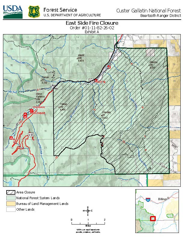
- A Forest Closure Order remains in effect for U.S. Forest Service lands immediately surrounding the fire area in the Custer Gallatin National Forest.
For more information, visit:
Current Impact
Impacts:
Injuries and Fatalities: There have been no reported injuries or fatalities associated with the East Side Fire.
Structures Impacted: Approximately 185 homes were initially threatened during the fire's rapid growth. Ground crews successfully implemented structure protection measures, including removing flammable brush and setting up sprinkler systems. No structures have been reported damaged or destroyed.
School and Business Closures: There are no widespread school or business closures currently reported in relation to this fire.
Notable Impacts: The fire threatened the Yellowstone Bighorn Research Association (YBRA) camp and prompted the initial evacuation of the Rattin Campground.
Safety Concerns:
Power Outages: No major power outages have been reported in connection with the fire.
Water Safety: No specific water safety concerns have been reported, though residents should monitor local advisories.
Burn Bans: While no specific new burn bans are reported for Carbon County, residents are urged to practice extreme caution due to the early onset of the fire season and critically dry fuels.
Air Quality: Smoke from the fire previously caused significant air quality impacts in the Red Lodge area. While conditions have improved with increased containment, residents—especially those with respiratory conditions—are advised to monitor air quality at fire.airnow.gov.
Ongoing Outlook
Containment Projections: With the fire currently at 70% containment, firefighters expect to make continued steady progress. Crews are focused on mopping up remaining hot spots, securing the fire's edge, and patrolling the northern perimeter near Red Lodge to ensure the fire does not escape established lines.
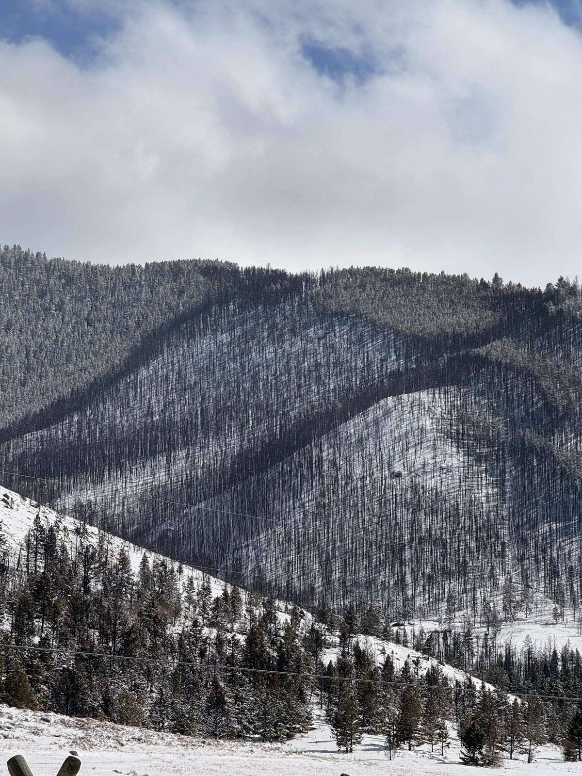
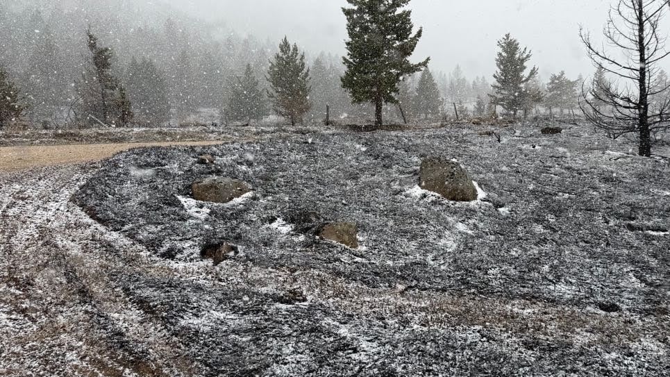
Weather and Wind Warnings: Recent cold fronts bringing cooler temperatures and precipitation, including rain and snow, have greatly aided suppression efforts over the last few days. However, fire managers remain cautious as shifting winds and unpredictable fire behavior remain a broader concern for the region as the season progresses.
Cause and the Role of Weather and Climate
Cause: The cause of the East Side Fire remains under investigation.
Weather and Climate: Montana is experiencing an early and intense start to its wildfire season. An abnormally warm winter, a lack of precipitation, and a fast-melting, below-normal snowpack have led to the early drying of fuels. These extreme, drought-like conditions have combined to produce significant fire activity well before the state's typical peak fire season, reflecting broader climate-driven trends across the Northern Rockies.
 View All