Qury
ACRES BURNED
9,168
STATE
South Dakota
ORIGIN COUNTY
CusterCONTAINMENT
100%
THIS FIRE IS STALE
This incident has not been updated in more than three days. Data may be inaccurate.
Response
LEAD AGENCY
Department of Agriculture & Natural ResourcesRESPONSE LEVEL
Type 4Details
INCIDENT DETAILS
FIRE BEHAVIOR
MinimalNEAREST CITY
Custer, SDDESCRIPTION
2 Miles SE from Custer, SD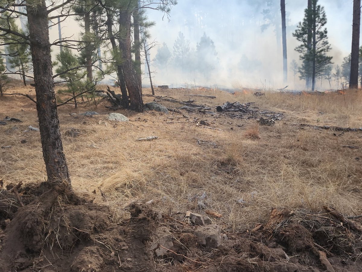
Qury Fire Report — April 2, 2026
Fire Start, Size and Growth
Start Date/Time/Location: The Qury Fire ignited on Thursday, March 12, 2026, around 1:00 p.m., approximately 2 miles southeast of Custer, South Dakota, in Custer County.
Size and Containment: As of the most recent data over the last 72 hours, the fire has burned approximately 9,168 acres and is 90% contained.
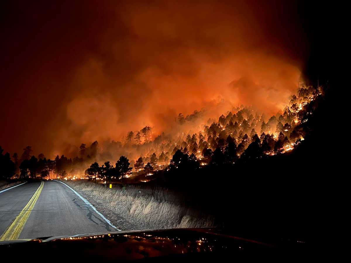
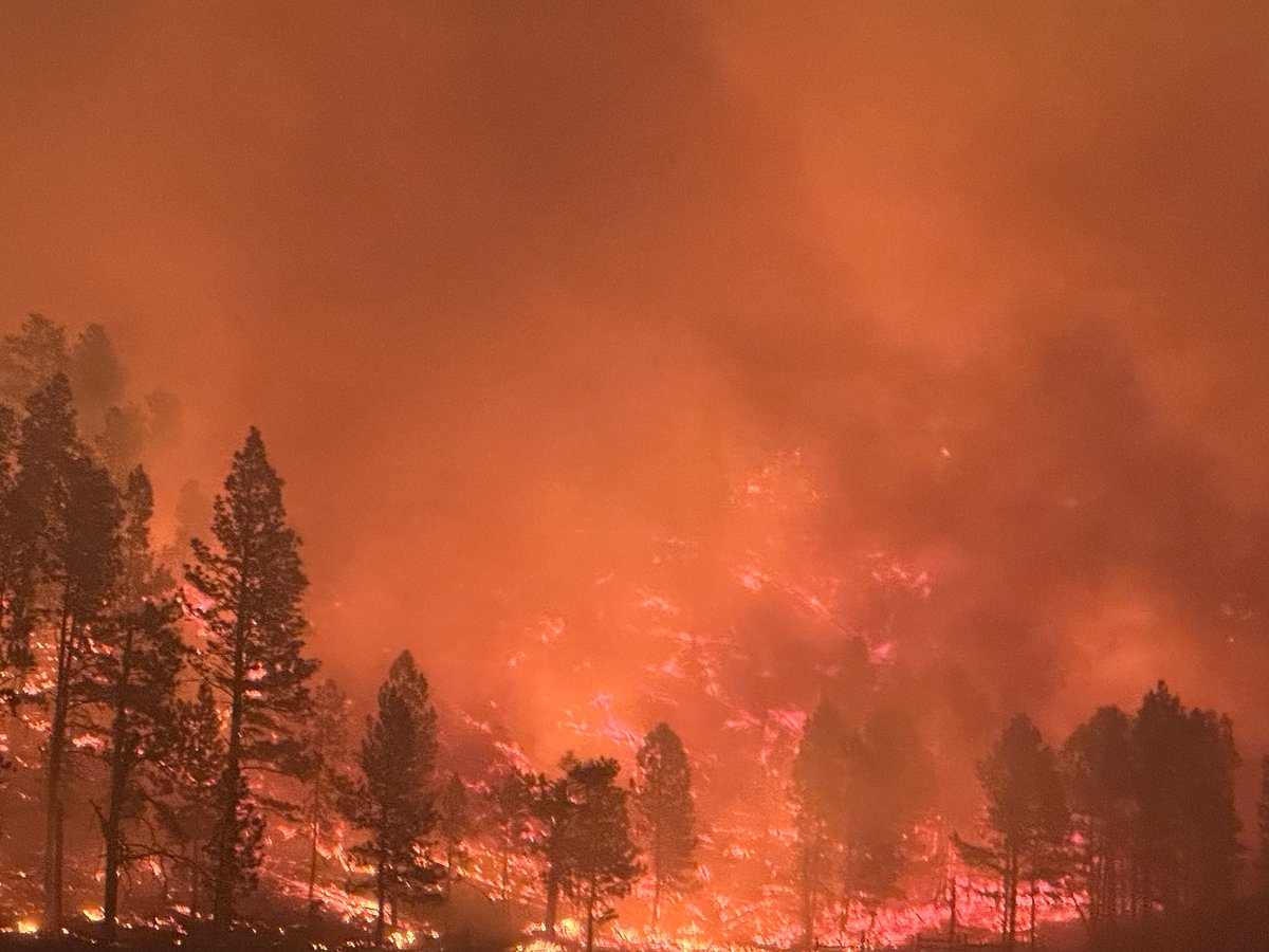
Fuels, Growth and Rate of Spread: The fire initially merged with the nearby Deer Fire and exhibited extreme fire behavior, including running fire, torching trees, and spot fires. It was primarily fueled by timber, heavy fuels, grass, and understory. Driven by strong winds and dry conditions, the fire made significant runs away from the city of Custer and encroached upon Custer State Park.
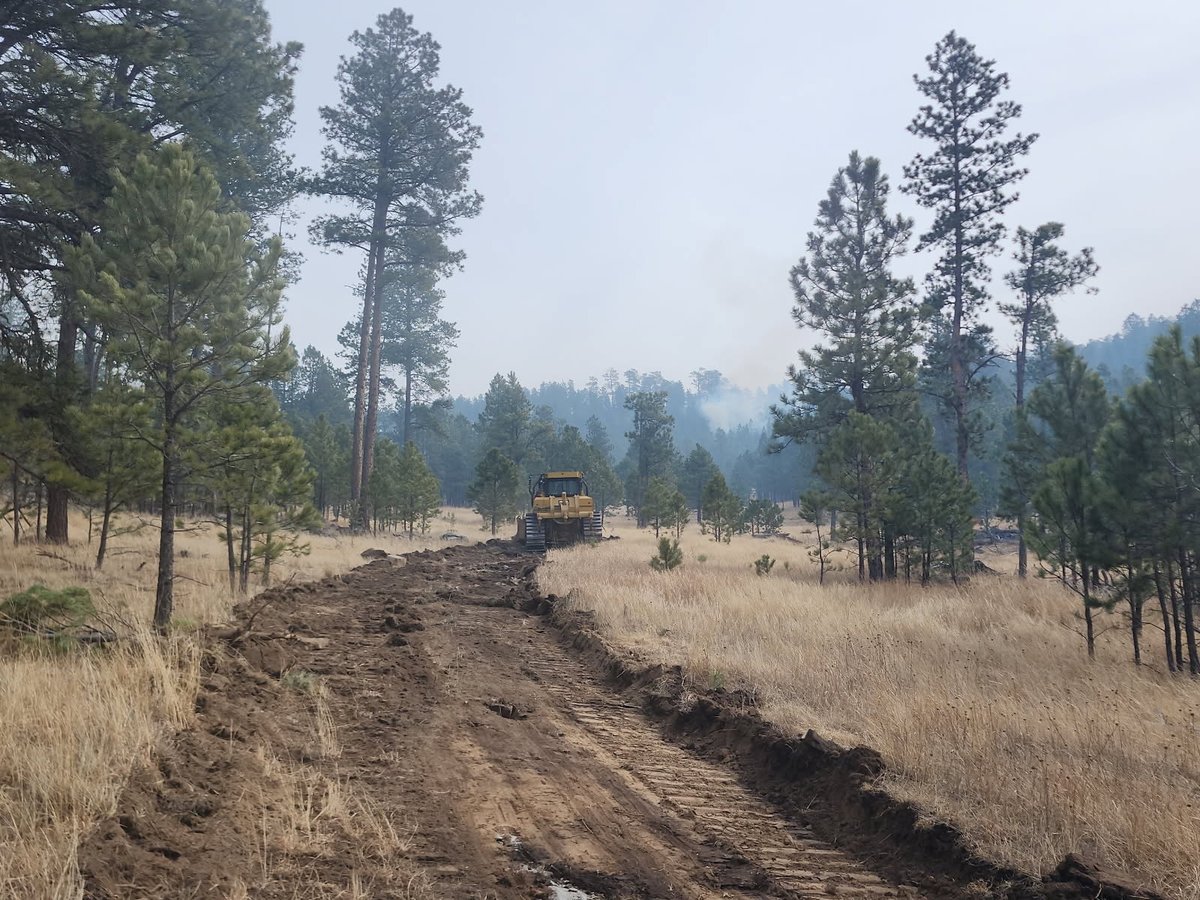
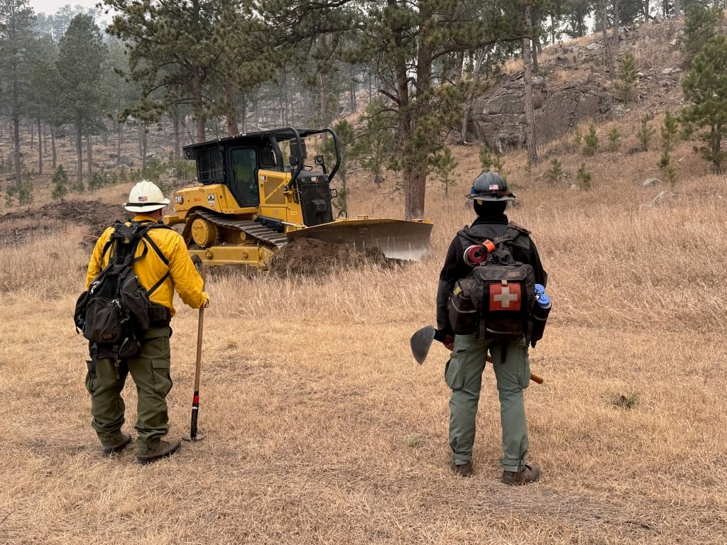
Containment Efforts: The incident has successfully transitioned to a Type 4 operation managed by local units, down from a peak of over 350 personnel and a Type 3 Interagency Incident Management Team. Firefighters are currently focused on patrolling control lines, mopping up, and repairing areas disturbed by bulldozers. Federal assistance was secured early on through a FEMA Fire Management Assistance Grant (FMAG) to support the response.
Emergency Information
Evacuations and Sheltering:
Mandatory Evacuation Orders: Evacuation orders were previously issued for areas including Lower French Creek, Hazelrodt, Glen Erin, Flynn Creek, and Herbert Draw. Repopulation efforts have been underway; however, access is restricted to residential traffic only.
Evacuation Warnings: Residents returning to the area must possess an Orange Card or RapidTag ID issued by Custer County Emergency Management.
Curfew: No specific curfews are currently reported, but unauthorized access to the fire area remains strictly prohibited.
Evacuation Shelters and Information: Displaced residents were advised to seek shelter at the Living Outreach Church, while the Custer Armory was utilized for emergency responders.
Road and Infrastructure Closures:
- Lower French Creek Road from Highway 16A to Highway 87.
- Highway 87 from 16A to the north boundary of Wind Cave National Park.
- The U.S. Forest Service has issued an emergency closure order (BKF-186-2026) for portions of the Black Hills National Forest, remaining in effect until April 16, 2026, to ensure public and firefighter safety.
For more information, visit:
- Custer County Sheriff's Office
- Black Hills National Forest Alerts & Notices
- South Dakota Wildland Fire
Current Impact
Impacts:
Injuries and Fatalities: There have been no fatalities or confirmed injuries reported in connection with the Qury Fire.
Structures Impacted: Structures on approximately 10 properties have been damaged or destroyed. At its peak, the fire threatened over 100 homes, as well as bridges, utilities, and communication towers.
School and Business Closures: No widespread school closures were reported in the last 72 hours, but local recreation areas and public lands within the Black Hills National Forest remain closed.
Notable Impacts: The fire burned up to Highway 87 in Custer State Park and neared Wind Cave National Park (which remained open). The closed forest areas are critical habitats for threatened and endangered species, including the black-footed ferret and northern long-eared bat.
Safety Concerns:
Power Outages: Black Hills Energy previously initiated a Public Safety Power Shutoff (PSPS) for around 560 customers in the southern Black Hills to prevent new ignitions; power has since been restored.
Water Safety: No specific water safety concerns have been reported, but residents should monitor local advisories.
Burn Bans: The Custer County Commission enacted a countywide burn ban due to the elevated fire danger.
Air Quality: Smoke from the fire and interior smoldering may continue to pose health risks and reduce visibility. A Temporary Flight Restriction (TFR) remains over the fire perimeter.
Ongoing Outlook
Containment Projections: With containment at 90%, the fire is largely in the mop-up and patrol phase. Firefighters are successfully holding the containment lines and cleaning up unburned "green islands" within the fire's perimeter. The local unit will continue to monitor the area for any remaining hotspots.
Weather and Wind Warnings: While recent snow and cooler temperatures helped slow the burning of light fuels, heavy fuels continued to smolder. A warming and drying trend with breezy conditions is expected in the region, but officials remain confident that the established control lines will hold.
Cause and the Role of Weather and Climate
Cause: The cause of the Qury Fire remains under investigation.
Weather and Climate: The fire was fueled by extreme fire weather conditions, including high winds and low humidity. This fire is a notable harbinger for the season, as the Black Hills fire season typically runs from May to October. The region experienced one of the warmest and driest winters on record, with Rapid City receiving only about half of its normal snowfall. This low snowpack and early-season snowmelt directly correlated with the greater risk and early onset of this wildfire.
 View All