LITTLE GIANT

active fire wildfire
ACRES BURNED

25,407

STATE

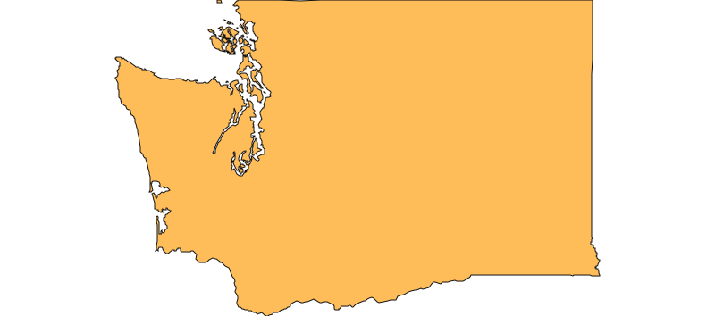
Washington

ORIGIN COUNTY
Chelan
CONTAINMENT

N/A

Environment
Right Now
Fair icon
59°F
Fair
Light Wind 6 mph · WNW
95
Moderate Air Quality
TODAY JUL 30 JUL 31 AUG 1
Weather Fair 59° 48° Partly Cloudy 71° 52° Mainly Clear 82° 56° Drizzle 72° 46°
Area Fire Potential
TODAY Low
JUL 30 Moderate
JUL 31 Low
AUG 1 High Burn Environment
Area Fuels
Timber (Litter and Understory)
Response
LEAD AGENCY
Forest Service
RESPONSE LEVEL
Type 1
688Response Personnel
Central Washington Interagency Communication Center
Details
NaturalFire cause not provided by NIFC
INCIDENT DETAILS
FIRE BEHAVIOR
Active
NEAREST CITY
DESCRIPTION
30 Miles NW from Leavenworth, WA

Inciweb Media

Recent media provided by InciWeb of Washington fire activity.

Firefighter Watching A Helicopter Take OffLittle Giant Smoke Outlook 7-29-2026Little Giant Fire Map 07-29-2026Public Information Officer at Plain HardwareLittle Giant Smoke Outlook 07-28-2026Public Information Officer at Plain Hardware Info BoardLittle Giant Fire AM Briefing July 27Little Giant Fire Smoke OutlookFarmer's Market Public OutreachSmoke Plume 7-25-2026Smoke Plume 7-25-26Trees along road 7-24-2026Little Giant Fire From Nineteen Mile Campground July 21, 2026Little Giant Fire 7_19_26Little Giant Fire 7_19_26Little Giant FireLittle Giant Fire 7_19_26Little Giant 7_20_26Little Giant Fire from flight.7.19.26Little Giant Fire from flight.7.19.26
From the Web
External data is not official This information is compiled automatically, and is not confirmed by a human reviewer. July 29, 2026 at 6:02 PM PDT

LITTLE GIANT Fire Report — July 29, 2026

Fire Start, Size and Growth

Start Date/Time/Location: The Little Giant Fire was ignited by a lightning strike on July 15, 2026. It is located in the Okanogan-Wenatchee National Forest, approximately 22 to 30 miles northwest of Leavenworth in Chelan County, Washington. The fire originated near the 19-Mile Campground in the Chiwawa River drainage.
Size and Containment: As of the latest official updates on July 28, 2026, the fire has burned approximately 24,361 acres and remains 0% contained.
Fuels, Growth and Rate of Spread: The fire experienced explosive growth over the past weekend, expanding from 7,000 acres on Friday to over 24,000 acres by Tuesday. It is burning in steep, rugged terrain near Little Giant Pass and Chiwawa Ridge. The fire is heavily fueled by dead and fallen vegetation left over from the 2015 Wolverine Fire. Its rapid spread has been driven south and east by dry northwest winds and escalating summer temperatures.
Containment Efforts: The California Interagency Incident Management Team 2, a Complex Incident Management Team, is managing the response. Currently, over 306 personnel are assigned to the fire, utilizing hand crews, engines, water tenders, and bulldozers. Firefighters are prioritizing the southern and eastern edges of the fire to protect property, creating defensible space around structures along the White River and upper Entiat Valley. Progress on the western edge has been slow due to rocky, high-elevation terrain that is largely inaccessible to ground crews. The estimated cost of the firefighting effort to date is approximately $2 million.

Emergency Information

Evacuations and Sheltering:
Mandatory Evacuation Orders: Level 3 ("Go Now") evacuation orders are in effect for the Trinity area up to Twin Creek Road (Forest Service Road 6209) and Chikamin Ridge Road (Forest Service Road 6210).
Evacuation Warnings: Level 2 ("Be Prepared to Leave") evacuation notices are in place for areas from Twin Creek Road to Meadow Creek (including Goose Creek Flat), and along Entiat Valley Road from the Entiat Sno-Park to Cottonwood (including the Myrtle Lake area). Level 1 Fire Advisories ("Stay Alert") cover areas from Meadow Creek to south of Fish Lake at Chiwawa Loop Road (including Pole Ridge), and Entiat Valley Road from the Sno-Park to Stormy Creek Road.
Estimated Impact: While exact population numbers for the evacuation zones are not explicitly provided, over 450 structures are currently threatened by the fire, impacting hundreds of residents in the surrounding rural communities.
Evacuation Shelters and Information: Residents are advised to monitor the Chelan County Emergency Incidents Map to verify their evacuation status and find local sheltering information.

Road and Infrastructure Closures:

  • Temporary emergency closures have been implemented within the Wenatchee River and Entiat Ranger Districts of the Okanogan-Wenatchee National Forest for public safety.
  • Chiwawa Road (Forest Service Road 6200) above Chikamin Creek Road (6210) is closed.
  • Phelps Creek Road (6211) is closed.
  • All trails branching off the 6200 Road and various recreation sites in the area are closed to public access.

For more information, visit:

Current Impact

Impacts:
Injuries and Fatalities: There have been no reported injuries or fatalities associated with the Little Giant Fire.
Structures Impacted: As of the latest reports, no structures have been damaged or destroyed. However, 452 structures remain threatened, including homes in the communities of White River, North Shore, Meadow Creek, Pole Ridge, and Fish Lake.
School and Business Closures: No specific school closures have been announced, but local infrastructure impacts include the widespread closure of national forest roads, campgrounds, and recreational facilities.
Notable Impacts: The fire is heavily impacting the Chiwawa River valley and popular local recreational areas, including the 19-Mile Campground and the Minnow Creek Trailhead.

Safety Concerns:
Power Outages: There are no widespread power outages reported in connection with this fire at this time.
Water Safety: No specific water safety advisories have been issued, but residents should remain alert to local updates.
Burn Bans: Level 2 fire restrictions are currently in effect for public lands within the Okanogan-Wenatchee National Forest.
Air Quality: Haze and smoke are visible in the area. Breezy winds are dispersing smoke across Central Washington, which poses health risks for sensitive groups and those with respiratory conditions. Residents are advised to monitor local air quality indexes and stay indoors if smoke becomes heavy.

Ongoing Outlook

Containment Projections: The fire remains 0% contained. Fire officials anticipate that containment will be a prolonged effort due to the steep, inaccessible terrain on the fire's western flank. Crews will continue to focus heavily on structure defense and building containment lines on the southern and eastern perimeters where the fire threatens residential communities.
Weather and Wind Warnings: While there is currently no Red Flag Warning in effect for the immediate area, breezy northwest winds (up to 15 mph) will linger through Wednesday, creating elevated to locally critical fire weather conditions. Temperatures are expected to remain cool to near seasonal normals in the 80s for the next day or two, but above-normal temperatures in the 90s are forecast to return later in the week, alongside continued dry conditions.

Cause and the Role of Weather and Climate

Cause: The Little Giant Fire was sparked by a lightning strike on July 15, 2026.
Weather and Climate: The fire's explosive growth over the past weekend was largely driven by high winds and escalating summer temperatures. Furthermore, the fire is burning through areas previously scarred by the 2015 Wolverine Fire. The significant accumulation of dead, dry, and fallen vegetation in this burn scar has provided ample fuel, exacerbating the fire's intensity and rate of spread amidst the dry regional climate.

For more information, visit: