OLD TRAILS
 active fire
  wildfire
 ACRES BURNED
3,619
STATE
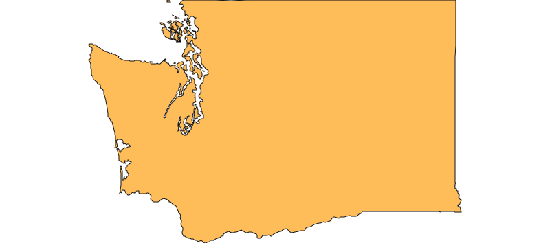
Washington
ORIGIN COUNTY
SpokaneCONTAINMENT
N/A
Environment
Right Now


| TODAY | AUG 4 | AUG 5 | AUG 6 | |
|---|---|---|---|---|
| Weather | 76° 50° | 82° 56° | 94° 61° | 97° 69° |
| Area Fire Potential | TODAY Low AUG 4 Low AUG 5 Low AUG 6 Moderate | |||
| Area Fuels | Timber (Litter and Understory) | |||

Response

LEAD AGENCY
Department of Natural ResourcesRESPONSE LEVEL
Type 1

Details

INCIDENT DETAILS

FIRE BEHAVIOR
Moderate
NEAREST CITY
SPOKANE
DESCRIPTION
3 Miles W from SPOKANE, WAOLD TRAILS Fire Report — August 3, 2026
Fire Start, Size and Growth
Start Date/Time/Location: The Old Trails Fire ignited around 12:00 p.m. PDT on Saturday, August 1, 2026, near Old Trails Road and Euclid Road in the West Plains area near Airway Heights, west of Spokane, Washington.
Size and Containment: As of August 3, 2026, the fire has burned approximately 3,619 acres and remains 0% contained.
Fuels, Growth and Rate of Spread: Fueled by abundant dry vegetation and pushed by severe 35 to 45 mph southwest wind gusts, the fire grew at an explosive rate. It rapidly blew northeast into Riverside State Park, jumped the Spokane River, and raced up the bluffs into densely populated neighborhoods including Indian Trail and Five Mile Prairie.
Containment Efforts: California Incident Management Team 7 is assisting local fire departments. Firefighters have successfully stopped the advance of the fire before it moved into additional neighborhoods, and fire activity has moderated significantly since the initial run. Governor Bob Ferguson declared a state of emergency and activated the National Guard to assist with the response.
Emergency Information
Evacuations and Sheltering:
Mandatory Evacuation Orders: Level 3 (Go Now) evacuations were issued for tens of thousands of residents. Impacted zones include areas from Five Mile to the North, Strong on the South, Five Mile to the West, and Waikiki on the East, as well as areas bounded by Price on the North, Francis on the South, Cedar on the West, and Division on the East.
Evacuation Warnings: Level 2 (Get Set) warnings are in place for areas including Magnesium on the North, Francis on the South, Division on the East, and Nevada on the West.
Evacuation Shelters and Information: The Spokane Convention Center is serving as the primary overnight shelter, housing hundreds of displaced families. An additional shelter is open at the Spokane Falls Community College small gym (3410 W Whistalks Way). An animal shelter has been established at the Spokane County Fairgrounds.
Road and Infrastructure Closures:
- Multiple local roads in the Indian Trail and Five Mile Prairie neighborhoods are closed to allow emergency access.
- Roads leading to several Spokane Public Schools in the impacted zones have been closed.
- Spokane Police have deployed extra patrols to secure evacuated neighborhoods and enforce closures.
For more information, visit:
- Spokane County Emergency Management
- Washington State Department of Natural Resources (WA DNR)
- Spokane Fire Department
Current Impact
Impacts:
Injuries and Fatalities: There are currently no confirmed reports of lives lost; however, officials are still assessing the heavily impacted areas for potential casualties given the fire's rapid urban spread.
Structures Impacted: The fire has caused catastrophic damage, destroying approximately 640 structures, including homes and businesses, primarily within the city limits of Spokane. Spokane Mayor Lisa Brown has described the event as the "worst natural disaster our region has faced."
School and Business Closures: The local VA hospital was evacuated as a precaution. Several Spokane Public Schools in the area lost power and road access.
Notable Impacts: The fire burned through the Spokane Rifle Club and caused damage to areas of the Fairmount Memorial Cemetery, though the main grounds and mausoleum were spared. The Dwight Merkel Sports Complex saw walls of flames, but the athletic fields remained intact.
Safety Concerns:
Power Outages: Avista Utilities reported that up to 40,000 customers in the Spokane area were without power. Many of these outages were preemptive measures to prevent further ignitions, though some utility infrastructure was damaged by the fire.
Water Safety: Firefighting efforts have put a significant strain on the local municipal water system. Residents should monitor local advisories.
Air Quality: The state has issued air quality warnings due to a massive plume of smoke billowing over the region. Residents are advised to stay indoors and limit exposure.
Burn Bans: Strict burn bans remain in effect across the region due to extreme fire danger.
Ongoing Outlook
Containment Projections: Although containment remains at 0%, officials report that the major danger of the fire advancing into new neighborhoods has passed. Firefighters are working grueling 30- to 40-hour shifts to build containment lines and protect remaining structures.
Weather and Wind Warnings: Cooler temperatures are providing temporary relief on Monday and Tuesday. However, fire officials warn that later in the week, temperatures are forecast to rise back into the mid-to-high 90s, with relative humidity dropping into the lower teens, which could challenge containment lines.
Cause and the Role of Weather and Climate
Cause: The exact cause of the Old Trails Fire remains under investigation. Avista Utilities confirmed the fire was not sparked by their infrastructure.
Weather and Climate: The extreme rate of spread was driven by historic fire weather conditions. Prior to ignition, the National Weather Service issued a first-of-its-kind "Particularly Dangerous Situation" (PDS) Red Flag Warning for Eastern Washington, citing soaring temperatures, extremely low humidity, and wind gusts up to 45 mph. Washington Public Lands Commissioner Dave Upthegrove noted that this is an "extraordinary fire season" fueled by unusual and extreme climate conditions in the Pacific Northwest.
 View All